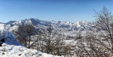
Photo 1 - 2 - Montella, a municipality in the province of Avellino, is at 547 meters above sea level in the Upper Calore Valley. The Montella plain is very fertile and is mainly cultivated with cereals and potatoes, vegetables, fruit such as walnuts and apples and chestnuts on the hills. Livestock farming flourishes, in particular cows, and an abundant production of fresh and seasonal dairy products.
Photo 3 - 4 - The Laceno plateau, with the lake, is located in the territory of Bagnoli Irpino (Av), at a height of 1050 meters above sea level. From Mount Raiamagra, (1700 meters above sea level), the Gulf of Salerno is visible, from Punta Licosa to the Amalfi Coast. The flora of the park consists of tall beech trees, chestnut trees, oaks, pines and fir trees. The fauna is represented by the presence of the spotted salamander, the Italian newt, the black woodpecker and also by birds such as the buzzard, the peregrine falcon, the sparrowhawk, the badger, the marmot, the eagle owl, the fox, the wolf, the lynx.
Visualizza Montella sulla mappa - View Montella on the map Visualizza Laceno sulla mappa - View Laceno on the map
© Copyright 2024 Vincenzo Avagliano - Reproduction of the photos without permission is strictly prohibited.
enzo.avagliano@libero.it - enzo.avagliano@vincenzoavagliano.com